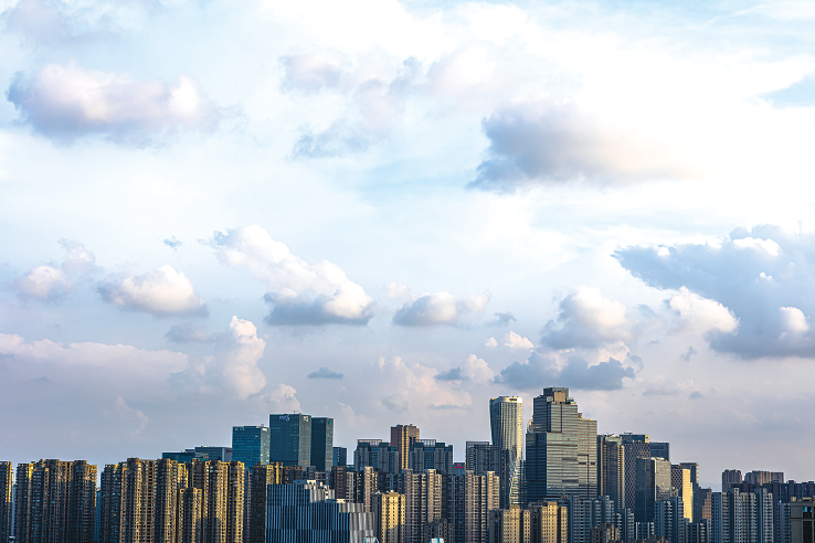
The recent cloud is very beautiful. Photo by reporter Xia Yang
As soon as August enters, typhoons gather intensively.
This year’s No. 9 typhoon “Lu Bi” (weakened into a tropical depression at 5 o’clock yesterday, but the Central Meteorological Observatory Typhoon News at 23:00 yesterday showed that it has strengthened into a tropical storm), plus the newly generated No. 10 typhoon the day before yesterday. “And the No. 11 typhoon “Nida” formed a three-rotation dance situation. Fortunately, they are far away from Hangzhou and will not have a positive impact on us. However, due to the existence of multiple typhoons, Hangzhou will continue to be affected by the easterly wind over the sea, and there will still be showers or thunderstorms in the next seven days.
Have you noticed that the clouds in the Hangzhou sky are very beautiful recently. This is because affected by the easterly air currents, the most beautiful sky of the year is now!
The easterly wind also brings relatively cool air on the sea, so the temperature in Hangzhou is not very high these days, the highest temperature is between 31-34℃. This kind of weather is really relatively comfortable in the “dog days”. The highest temperature in the next few days is expected to be similar, with easterly winds of 4-5. However, the residual peripheral cloud system of the typhoon will bring rich water vapor to Hangzhou as the east wind moves westward. There will be more rain and thunderstorms in the next few days. Among them, 10-12 days will be affected by the high-level weak cold air, and there will be more significant rainfall. During the process, please pay attention to prevent short-term heavy rain to heavy rain.
Liqiu today
But it’s still early in autumn
Ah? Today is Liqiu!
The “2021 Chinese Astronomical Almanac” shows that at 14:54 on August 7, Beijing time, we ushered in the “Beginning of Autumn” solar term. “Liqiu” is the thirteenth solar term in the twenty-four solar terms, and it is also the first solar term in autumn.
But the beginning of autumn is not the same as the beginning of autumn, Hangzhou is still far away from autumn! According to the meteorological explanation: the summer temperature in Hangzhou is mainly affected by typhoons and subtropical highs, while Minyan is the time point of solar terms applicable to the whole country, and the two are not related in meteorology.
In meteorology, autumn requires 5 consecutive days with an average daily temperature below 22°C. According to this standard, the ones that can enter autumn during the beginning of autumn, except for high-altitude areas such as the Qinghai-Tibet Plateau, are mainly the northeastern part of Inner Mongolia and Heilongjiang. The representative of the provincial capital is Harbin (autumn on August 11th).
The Central Plains is still summer’s sphere of influence. After all, according to the three-volt algorithm, “Liqiu” is often still in the second-volt (also called mid-volt) period on this day. The so-called “Hot in the winter”, and “A fall after autumn” said that the real coolness generally comes after the Bailu solar term.
The middle and lower reaches of the Yangtze River generally only usher in autumn around the National Day. As for southern China, such as the Guangzhou area, it is generally not until the end of October and the beginning of November to say goodbye to summer.
“Lu Bi” continues to bring wind and rain
In late July this year, the number of high temperature days in Zhejiang was too few
Affected by typhoon “Lu Bi”, there were heavy rains and local heavy rains in Wenzhou and Taizhou the day before yesterday. The weird “Lu Bi” first weakened into a tropical depression yesterday, and then strengthened into a tropical storm. Moreover, its moving speed is slower and the impact time is longer, so the wind and rain will not stop.
Affected by this, it is expected that most parts of our province will be mainly cloudy from today to 9th, and there will be many showers or thunderstorms in the afternoon of 10-13. Among them, the shear line will be affected around the 11th, and some areas in northern Zhejiang will be more obvious. Rain.
On the other hand, due to the subtropical high north and east, the easterly airstream brings fresh and cool air on the sea, making it difficult for high temperatures to rise. According to data, as of August 5, since late July this year (July 21-August 5th) The average temperature in our province is only 31.4℃, which is 2.3℃ lower than the same period. The average number of high temperature days is also obviously less. There are 6 days per year, but only 1.4 days this year.
However, it is worth noting that once it clears, the temperature will gradually rise. In the next seven days, the highest temperature in most parts of our province will be 31-35°C.