Whether pine trees in Brandenburg and in the Harz Mountains or fir trees in the Black Forest – many conifers are becoming too warm in Germany due to climate change. The wood, which used to be very popular with foresters because of its rapid growth, is now susceptible to pests such as the bark beetle. As a result, many trees have been severely damaged or died off completely in the past five years. Individual deciduous tree species such as beech were also affected.
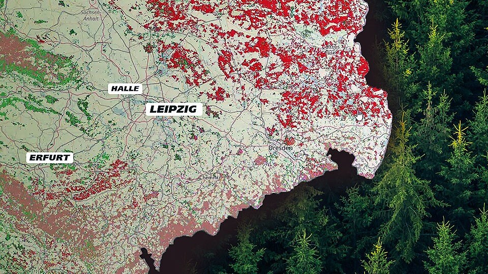
It is therefore important for forest scientists and authorities to find out which forests are dominated by which tree species. This allows them to see where the conversion of forests to resilient, resilient forests is lagging behind. The Thünen Institute, federal research institute for forests, among other things, has now published two interactive maps on the Internet that show both the wood stock and the dominant tree species in Germany. The data is as of 2018.
Forest map 95 percent reliable: where trees were in 2018
The digital maps were created using data from the Copernicus environmental satellites. They were then checked and supplemented using the sample data from the 2012 National Forest Inventory and the 2017 carbon inventory. This enabled the scientists to statistically calculate how reliable the satellite data is, because of course the electronic eyes from Earth orbit cannot reliably identify every tree or determine the tree species.
“The map of wooded woodland is 95 percent reliable. That means 95 percent of the areas shown on the map were actually trees in 2018,” explains Michael Welling, spokesman for the Thünen Institute. The system was slightly less accurate in determining tree species. Here, the information for the dominant species is 75 percent correct. “The system still has problems, especially with very young tree populations with a high level of diversity,” says Welling. In old, relatively homogeneous forests, on the other hand, it is very reliable.
A click on the map shows: In East Saxony and south of Jena the pines dominate in red, while in the Ore Mountains, Thuringian Forest and in the Upper Harz there are mainly spruces (in brown) and in the foothills there are more beeches (green).
Data from the fourth national forest inventory should be available in 2024
The 2018 data is also a glimpse into the past, into the state of the forest four years of extreme drought. In 2018, 2019, 2020 and 2022 it rained very little in the summers. The damage caused was enormous, for example in the Oberharz but also in Saxon Switzerland, where large areas were destroyed by forest fires.
The fourth round of the National Forest Inventory is intended to show the extent of this damage. Until the end of December 2022, researchers randomly examined the condition of the forests on the ground. The evaluated data should be available in 2024, satellite data could then be included again. However, researchers can only find out a lot through site visits. “What is of particular interest is the question: how much wood is in the forests, how thick are the trunks, how many are there and how is the biodiversity,” explains Welling.
