The municipality of Teglio, the pizzocchero capital, renews its website and launches a new App tailored for sportsmen. They can thus discover the area in complete safety
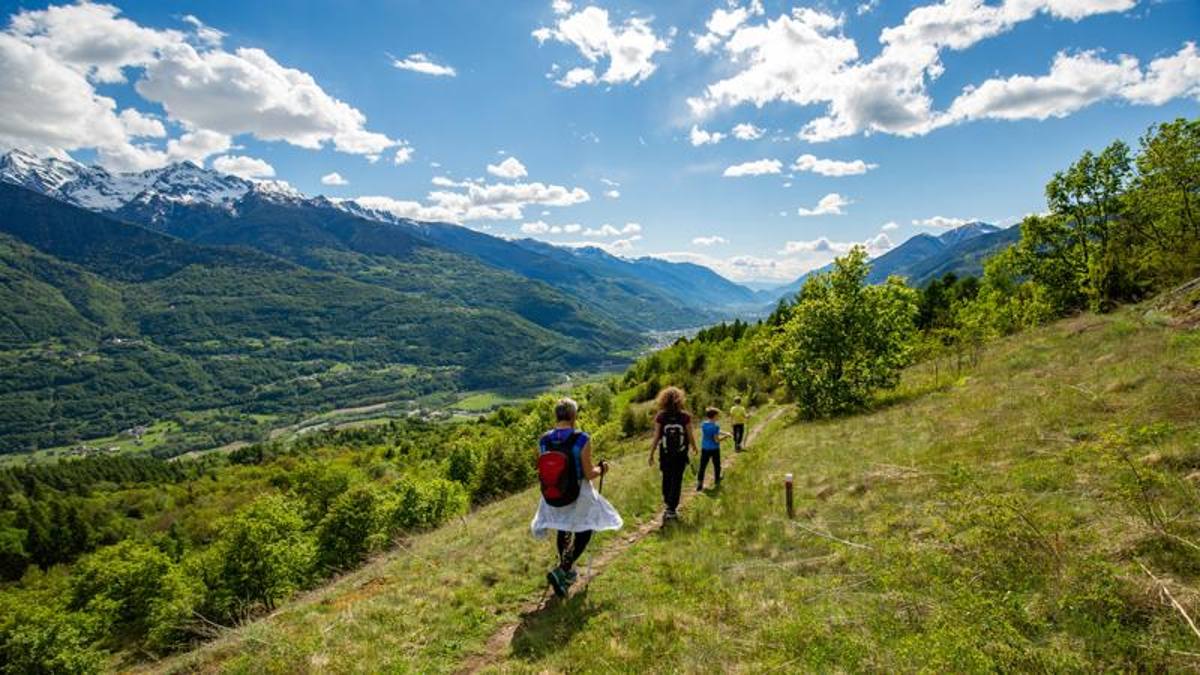
To be there capital of pizzocchero it is not enough. Nor to be part of the restricted circle of the “most beautiful villages in Italy”. So Teglio, one of the most evocative towns of the Media Valtellina, has decided to enhance its territory by promoting in particular the paths for hikers and mountain bike enthusiasts that wind through its territory.
An App to always be “accompanied”
—
How to make these itineraries known? With the help of technology, with the renewed website www.teglioturismo.com and the brand new app “Discover Teglio”. The portal – capable of providing timely information and guaranteeing simple and intuitive navigation – is aimed primarily at lovers of slow tourism, attentive to people and responsible for the environment.
The same philosophy is the basis of the App: thanks to GPS tracking, the application gives the possibility to walk with serenity to always have a point of reference, but also offers thematic itineraries to learn about the art, culinary traditions and history of the territory. Each user can save their virtual travel diary and insert impressions, photos and additional information on the places visited, which they can later decide to share with their friends.
Trek & bike in the secret Valtellina
—
The two-hour excursion from the hamlet of San Giovanni leaves the Dos de la Forca, so called because it was formerly used for capital executions, passing by an interesting archaeological site where you can observe cup-shaped and canal-shaped rock engravings that are visible on the smooth rocks. Just longer (2.5 hours) is the itinerary that leads from the center of Teglio to the Source of the Frascesca developing almost entirely in the shade of broad-leaved woods.
A fun mountain bike itinerary, on the other hand, leads from San Giacomo alla Val Caronella. The route develops in a ring, touching San Sebastiano, Caprinale, Monegatti and Carona, measuring 26.8 km with an altitude difference of 1,000 meters. The first part, up to Carona, has undemanding slopes and is located along a path with dense vegetation. The next sector develops on an unpaved and concrete road, with some rather steep steps, up to a picnic area set up on a large shelf. Return to the starting point by the same ascent route.
Follow us on our social channels!
July 10 – 10:27
© breaking latest news
.