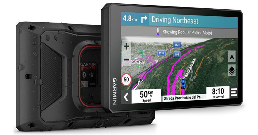
The American Garmin has announced the new zūmo XT2 motorcycle navigator, featuring a large 6-inch display that can be used comfortably even with gloves and with excellent backlighting. The screen offers an extremely clear view of the map and route, can also be used in the rain (IPX7 certified, which in theory allows it to remain completely submerged at a depth of 1m for up to 30 minutes), and is designed not to damage even if it comes into contact with a few drops of fuel while refuelling.
Particularly robust, the new zūmo XT2 is the evolution of the XT which improves in many respects without distorting its substance. In fact, its use does not change: in addition to the classic shortest route to get to your destination, this navigator allows you to choose “the most tortuous road” by setting four different levels of complexity. The highest one does not exclude the use of unpaved roads, but to avoid ending up on some path that is impossible to follow, it still uses the Popular Routing criterion, i.e. the one that takes into consideration the roads chosen by the greatest number of motorcyclists.
Stackable maps on layers
The navigator has preloaded the Green Guide and Michelin panoramic road maps of Europe and the Middle East, which can be updated free of charge. If necessary, you can replace the preloaded maps with others for Africa, North America, South America and Australia/New Zealand. In addition to the maps, various Points of Interest (POI) belonging to databases such as Trendy Place, Local Spot, Triadvisor and others have been preloaded. It is also possible to use the topographic maps based on OpenStreetMaps data at a scale of 1:25,000. By selecting a certain area from the device, it is finally possible to download the satellite images of the area. In fact, it is possible to superimpose the information from these different maps and databases for a complete and customized cartography.
Perfect sync with the app
The XT2 integrates seamlessly with the Garmin Tread smartphone app (Android and iOS) for easy visual route planning to integrate itineraries with the same maps and preferences on both the device and the app.

If you connect to a Bluetooth headset, you can hear turn-by-turn directions with street names spoken.
