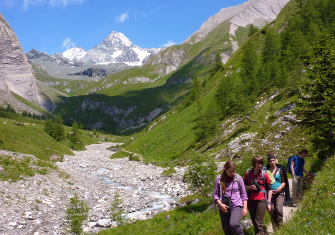
It has been more than 10 years since the Cammino dell’Aquila, the Alpine route that runs along the Alpine peaks of East Tyrol, East Tyrol in Austria, is passable to allow hikers to go and admire this beautiful bird of prey that hovers proud and free in the skies and at the same time admire the panorama of the valleys below. The entire Way of the Eagle is an itinerary made up of 9 stages, from Ströden, at the foot of the Großvenediger, to the Stüdlhütte refuge on the Großglockner, for a total of 100 km. Completing the most beautiful connection between two of the highest mountains in Austria means facing a difference in altitude of almost 8,000 meters, but you can also tackle only some sections, retracing the footsteps of the great pioneers of the Alps, with the added convenience of staying overnight in some beautiful high altitude alpine huts.
The mountain bike routes in East Tyrol
The Way of the Eagle is not the only reason to head towards theEast Tyrol: in the Lienz Dolomites bike arena alone there are 40 mountain bike routes, a third of the total 120 mapped with GPS tracks and signs throughout the region, for a total of over 1,000 km. You can also if you want proceed into the Hohe Tauern National Park, the oldest and largest national park in Austria, as long as you fully respect its nature. Or tackle the ascent from Ströden to Matrei to enjoy the breathtaking view of the mighty Umbal Falls. Or from the Forza della Natura Trail you can then observe the immense force of one of the last free-flowing glacial flows up close, and finally walk the last 20 kilometers or so along the Isel, which are mostly downhill.
Even the Circular path of the Lucknerhaus has grandiose panoramas in store: the Großglockner road from Kals climbs up to the Lucknerhaus (1920 m) with a difference in altitude of around 600 metres. Those who still have breath can reach one of the huts in the surrounding area, while the others enjoy the view of “King” Großglockner (3798 m) from the sunny terrace.
> Read also: To discover: hiking, nature and mountain pastures in East Tyrol
The new Defereggental Golf Park
And for those who prefer to admire the panorama of the mountains from below, dedicating themselves to less physically intense sports activities, there is the new golf course in St. Veit in the Defereggen Valley. The “Defereggental Golf Park” was created at an altitude of 1300 m in one of the most beautiful high mountain valleys in Austria, between pine forests and mountain villages. With open and covered teeing pitches, the large putting green and the chipping area, the 9-hole, par 3 golf course offers optimal training conditions for golfers of all levels. While the beginners, assisted in the best way, reach the qualification of GA in just five days, the cracks hone their technique with video analysis and make use of the valid advice of the professionals of the Akademie Dolomitengolf (Golf Academy in the Dolomites). Particular attention is paid to the short game.
> Read also: Adventure and relaxation in Lienz for the whole family
Advertising
